 Use Marker Groups
 Wolf 2002
Piru 2003
Day 2006
Zaca 2007
Gap 2008
La Brea 2009

From Highway 126, turn north on Piru Canyon Road. Drive 6 miles to the Lake Piru gatehouse and inform staff that you are hiking the Pothole Trail. There is no fee for accessing the Forest Service Trailhead, but they will give you a parking pass and ask a few questions about your trip. Drive approximately 5 miles on Piru Canyon Road to the Pothole Trailhead (34.511726, -118.762658). The trail switchbacks up the ridgeline for 2.7 miles, enters the Sespe Wilderness, and descends into the Potholes for another 2 miles. A loop hike may be taken by connecting with the Agua Blanca Trail (19W10).
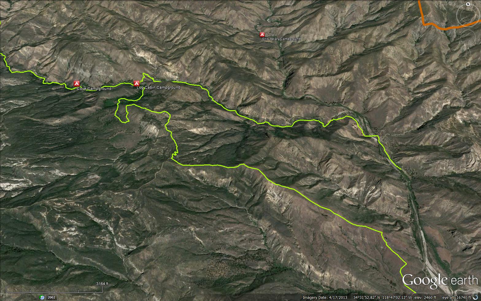
This trail branches from the Agua Blanca Trail just upstream from the Devils Gateway and before you reach Log Cabin Camp. It climbs up a small south side canyon with a small stream in its bottom. Reaching the head of the canyon you come to Pothole Spring; with an old cabin and farming tools that all had to be packed to the cabin area on mule back by William Whitaker. Following the trail south for a short distance, you come to a trail junction. The right hand fork is little used and leads to The Pothole. After leaving the junction, Trail 18W04 climbs steeply to reach the top of a north south ridge. Here there are excellent views of the Devils Gateway far down below you and then on up Piru Creek to the Big Narrows. Finally, it steeply descends to the road between Lake Piru and Blue Point.
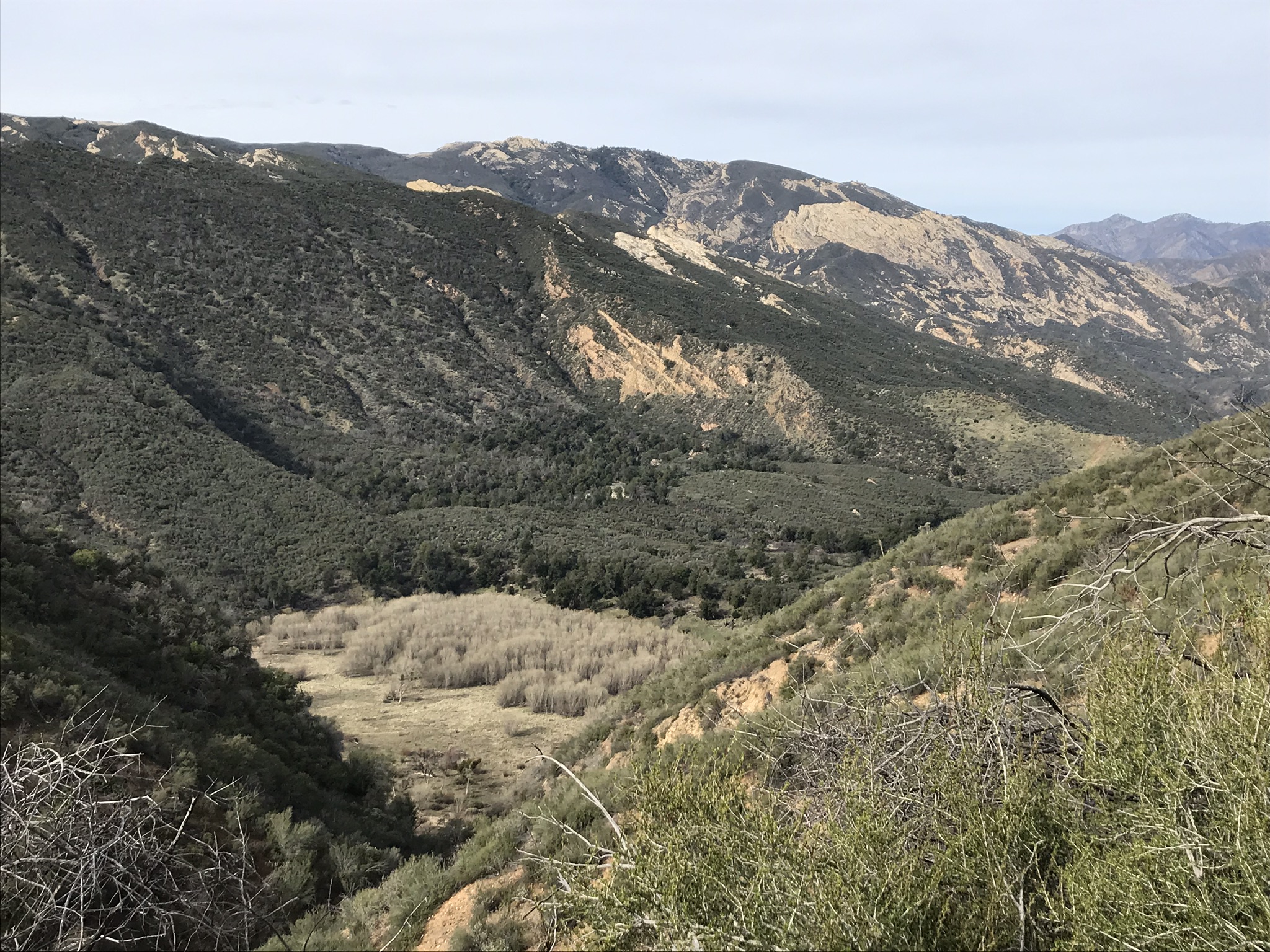
The Pothole is caused by a gigantic slide that descended across the canyon forming a large dam. Over the years, the area back of the dam has filled in with sand and silt until it has now formed a floor. This area sometimes floods for a very short period after very heavy rain. A grove of cottonwood trees covers part of the flat area.
Where the trail enters The Pothole the entrance is partially covered by sand, silt and weeds and the remains of an old horse drawn hay rake. The hay rake was used by William Whitaker when he cut the mature grass for hay.
POTHOLE SPRING
Water seeping into the aquifer at The Pothole seeps out down the canyon to form a small marsh at the spring. William Whitaker filed on 80 acres and by Cash Entry, in 1891 for which he received a Patent. He built a small cabin and packed numerous farm tools up by mule back to farm at the spring as well as The Pothole.
Log Cabin (1510 feet)


 Pothole Trail Survey - 04-14-2026 - by Paul Cronshaw
| Link: | Pothole Trail |
| Date: | 04-14-2026 |
| Surveyor Name: | Paul Cronshaw |
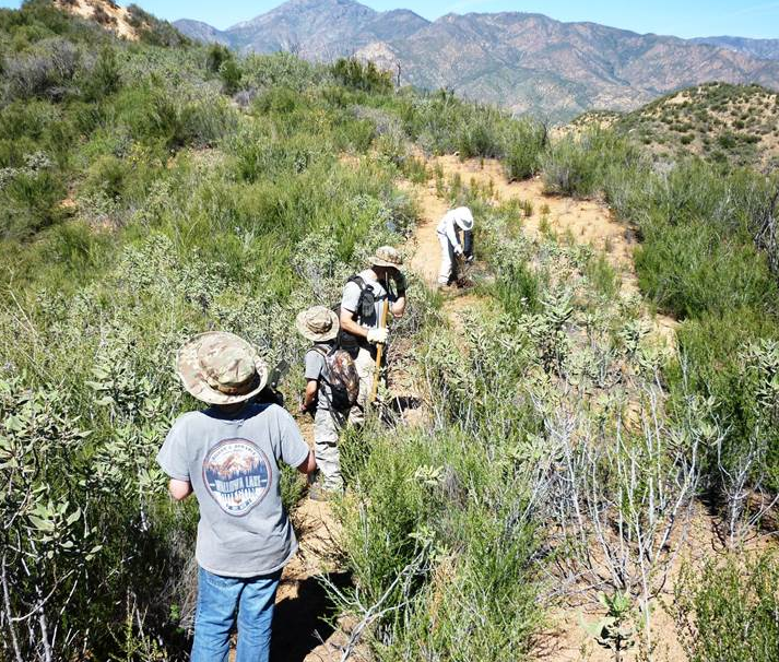
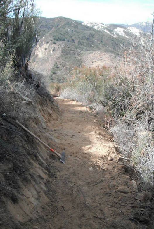
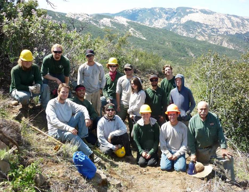
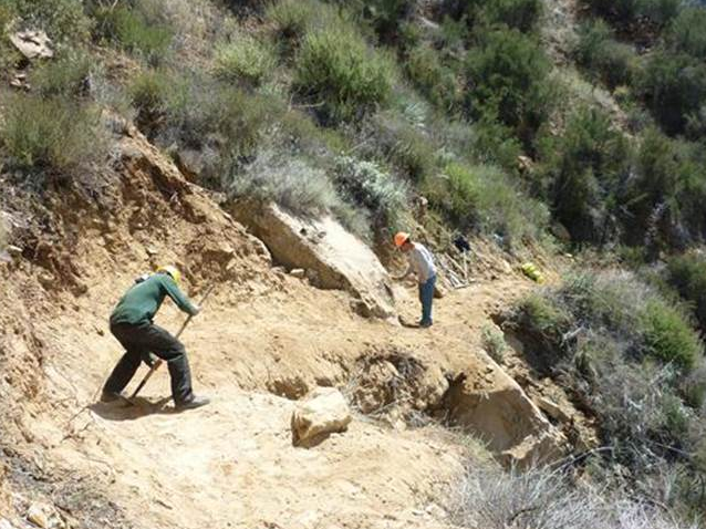
| Trail description: | LPFA organized a 5 day working vacation to put the finishing touches on the new Pothole Trail reroute. The volunteers who participated learned a lot of trail building techniques. This trail has been rerouted from a very steep old bulldozer scar to a new trail which starts from the parking lot and switchbacks up to connect with the original trail. The new trail is a much nicer hike. It only adds about a mile additional distance to the trail. |
| Mode of transport: | Hike |
| Trail condition: | Good shape and easy to follow |
| Images: | Potholes Parking lot New Trail section at beginning New Trail section midway up Trail route near junction View of Lake Piru from junction with old trail |
Pothole Trail Survey - 03-21-2026 - by Jonathan Rocque| Link: | Pothole Trail |
| Date: | 03-21-2026 |
| Surveyor Name: | Jonathan Rocque |
| Trail description: | Took the trail from Agua Blanca to the Pothole Trailhead. After coming up out of the Pothole, the trail was easy to follow as it was pretty much the only route out there. Other reports talk about a steep descent and we followed flagging to a series of switchbacks that took us to the trailhead parking lot. There were signs of recent trailwork which made the hiking much smoother on those sections. Be prepared for some brushy sections which will constantly whip your shins along the ridgeline routes. In addition, the ascent from Agua Blanca to the Pothole had a lot of poison oak growing into the trail. Plan to hike this trail earlier in the day or later in the afternoon. It's very exposed and we were baking in the sun for several hours during the peak heat of the day. The views are amazing and particularly when you're at the top of the Pothole. If I did this again I'd come into Agua Blanca, via Pothole, and then take the Agua Blanca Creek route back out. |
| Mode of transport: | Hike |
| Trail condition: | Needs some work |
Pothole Trail Survey - 01-31-2026 - by Jonathan Maguire| Link: | Pothole Trail |
| Date: | 01-31-2026 |
| Surveyor Name: | Jonathan Maguire |
| Trail description: | I took the Potholes trail to the Log Cabin Camp and then the Agua Blanca trail back to the lot for a nice loop. The potholes trail is findable and in decent condition. It first follows a fire break steeply up a ridge. As such it is very grassy with no shade whatsoever. There are also excellent views as a result. I was very surprised at how few ticks I brushed off given the grassy vegetation. Seems like this section could easily become overgrown and/or tick infested but it wasn't on this fine late January day. At one point I found myself wishing for switchbacks and noticed some on the next ridge. I couldn't find whatever trail that is on the maps and, though I looked, I also couldn't find any connection to it on my route. I also looked briefly for it when i returned to the lot but couldn't find anything there either. Hopefully a new improved route is in the works. After climbing up the steep shadeless firebreak the trail follows various ridge tops. Beautiful views can be enjoyed in every direction here. Eventually the trail descends into the big pothole. There is plenty of what I've heard people call "deer weed" but I've come to think of as "tick weed" growing into the trail here, so more ticks. The pothole itself is really nice with lots of large mature oaks. The quantity of small flies kept me moving at a good pace. I thought of stopping here to eat but the flies were quite aggressive. I soon came to log cabin camp which looks nice enough with plenty of level spots around to pitch a tent and a rock fire ring with a few rocks around to sit on. The cabin itself is surely occupied by critters so personally I wouldn't spend any time in it. There were more flies here than anywhere else on the whole route so I stayed a few seconds to take a photo before they shooed me away. Next I moved quickly through a short buggy section that follows and crosses a drainage several times down to Agua Blanca creek itself. Several sections looked like they'd slip out soon due to undercutting along the embankment but they were still intact on this day. Between the pothole and Aqua Blanca there a couple large trees/branches that have fallen across the trail but easy enough to climb over. I crossed the Agua Blanca creek for the first of countless times and found the Agua Blanca trail ascending to the right just on the other side thanks to orange tape flagging that trail crews must have left tied to a tree. Most of the crossings I used had this tape and between that and my GPS I was able to stick to the trail with minimal backtracking. The tape is deteriorating in places and may be gone already at a couple crossings so if this is the main way for people to find the trail then it probably needs replacing soon. Just after the first crossing the trail enters the creek and the narrows, which were beautiful and full of water. Traversing in and around the creek is a lot of fun and made me forget about the flies which were ever-present but not as bad as at the pothole or cabin. I brought water shoes which I would think essential for this hike and wore pants that convert to shorts. From start to finish while in the creek the water I waded through was no more than 2 feet deep. You could find deeper water if you wanted to but you could also avoid it. There were also a few large trees/branches that have fallen across the trail but easy enough to climb through. Traveling through and around the creek was fun but also made for a slower pace. After a few fun miles the trail/creek section ends and a dirt road picks up at Rancho Agua Blanca, and there is signage indicating that you are now on private property. Further down the road I entered another more well-kept ranch in a large green open field marked with no trespassing signs. Hopefully some sort of easement exists for hikers to pass through these properties. Several hundred feet away there were 6 or 8 cows and at least one bull and one calf and they all turned towards me and stared for a bit. I was forced to realize that I wasn't sure how to handle an encounter with a bull in an open field. Thankfully the bull and calf turned and trotted into the bushes towards the creek and the others followed. A passed through the area where the cows once stood and soon came to cross the creek again. It was probably 30 feet across here and 1-2 feet deep with a good current, lots of water. Never saw the cows again. After this crossing the road peters out and becomes unfindable. I don't know how the owners of those private properties have any vehicular access through here. There are no more orange flags either so the navigation is only by GPS and footprints. After hiking through what felt more like a river bed than a creek and doing some backtracking to find crossings that were shallow enough and with a gentle enough current, I did reach a paved toad in decent condition for the remainder of the walk back to the lot. The views of the canyon, mountains, creek and lake from this section are some of the best of the whole hike. This was an awesome loop hike and I'd definitely do it again. According to my GPS the route I took, which included some backtracks, was about 12 miles and about 2100' of cumulative ascent - almost all of the ascent in the first few miles. It took me about 5.5 hours including a few quick breaks. I counted 47 ticks that I brushed off me, most of them on the Agua Blanca trail, but these were one or two at a time. I was never covered in countless of them as I have been elsewhere. I didn't see any poison oak but it was January so I assume it was dormant. No animal encounters save the cows and one small snake by the creek; no humans whatsoever. Lots of flowers. I took some pictures to upload but couldn't get the upload to work. |
| Mode of transport: | Hike |
| Trail condition: | Good shape and easy to follow |
Pothole Trail Survey - 01-01-2026 - by JR| Link: | Pothole Trail |
| Date: | 01-01-2026 |
| Surveyor Name: | JR |
| Trail description: | I did The whole loop before Christmas and dressed up to the top and back on New Year’s Day. The trail was in good shape before Christmas, but coming back on New Year’s Day. There is so much new grass on pothole , the trail is getting obscured. Download a GPS map and you should be fine. |
| Mode of transport: | Hike |
| Trail condition: | Good shape and easy to follow |
| Images: | Near the top |
Pothole Trail Survey - 04-13-2025 - by Anonymous Surveyor| Link: | Pothole Trail |
| Date: | 04-13-2025 |
| Surveyor Name: | Anonymous Surveyor |
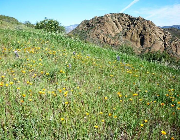
| Trail description: | The trail is in good condition. The only note is that if a person is hiking ccw then there is a small intersection at the top of the ridge on the descent to the cars that shows a faint trail and a trail with flagging. DO NOT follow the flagging!! This leads to a dead end and having to bushwhack across the hill to find the other trail. The flagging should be removed. No water except for along Aqua Blanca. Very little wildflowers. Missed the bloom by a month or so. Some lupine and poppies. |
| Mode of transport: | Hike |
| Trail condition: | Needs some work |
| Condition details: | pretty good condition |
Pothole Trail Survey - 03-01-2025 - by Addison Jerlow| Link: | Pothole Trail |
| Date: | 03-01-2025 |
| Surveyor Name: | Addison Jerlow |
| Trail description: | The first half mile or so that climbs the grassy hill has turned into a user trail straight up the ridge and skipping the switchbacks, needs some work to redefine correct route. Great shape from saddle until bottom of switchbacks dropping to the Pothole. A few small slides near the bottom. Great shape from the Pothole down to the Agua Blanca junction. Water in creek below Pothole Spring, cold and clear. |
| Mode of transport: | Hike |
| Trail condition: | Good shape and easy to follow |
| Images: | |
Pothole Trail Survey - 03-15-2025 - by Laura Clay| Link: | Pothole Trail |
| Date: | 03-15-2025 |
| Surveyor Name: | Laura Clay |
| Trail description: | 3/15-3/16 Pothole trail to Log Cabin Camp, back to parking via Agua Blanca Trail Pothole trail: fairly steep with no shade, but in good condition. Last portion uphill has lots of bushes to push through but trail is mostly defined. Some spots where "trail" splits from visual/gps trail, but all meets up in the end. Log Cabin camp: lots of flat ground and wood for fires (when permitted). Water is NOT close to camp at all, at least closest we could find was walking down to Agua Blanca creek probably .3 miles and uphill on the way back to camp was annoying. Plenty of water right now. Lots of critters in the metal cabin skittering throughout the night, noisy frogs, and lack of any seating for the campfire ring made this a very average but not great campsite. Agua Blanca trail: We made our way downhill back to the parking area, almost immediately had to get our feet wet which made the decision to walk through the pools in Devil's Gateway (where the canyon walls are high on both sides) easy. Got wet up to about knees. Rest of trail back fairly simple to follow with orange flagging at creek crossings, obvious recent maintenance helped. Some poison oak, but didn't seem too crazy (yet). HOWEVER, our dog was with us and we brushed off 5 ticks plus pulled 6+ more that had bitten. So beware! Last ~2-2.5 miles on dirt then paved road with no shade, a little demoralizing. |
| Mode of transport: | Hike |
| Trail condition: | Good shape and easy to follow |
Pothole Trail Survey - 11-30-2024 - by Alan Coles| Link: | Pothole Trail |
| Date: | 11-30-2024 |
| Surveyor Name: | Alan Coles |
| Trail description: | Crew of 7 worked the trail from upper stream crossing to Devils Potrero. Cleared brush, fallen trees and improved the tread. Restored original tread near cabin. There are still 4 logs to clear but easy to get over/around. |
| Mode of transport: | Hike |
| Trail condition: | Needs some work |
| Condition details: | Trail crew |
Pothole Trail Survey - 11-10-2024 - by Alan Coles| Link: | Pothole Trail |
| Date: | 11-10-2024 |
| Surveyor Name: | Alan Coles |
| Trail description: | Our crew of 10 went in on the AB and cleared the Pothole Trail up to the high crossing of Pothole Spring. There are still several trees and fallen branches to clear but the section from AB up to the cabin is in much better shape and easy to follow. |
| Mode of transport: | Hike |
| Trail condition: | Needs some work |
| Condition details: | Trail crew |
Pothole Trail Survey - 11-05-2023 - by Jaime Santana| Link: | Pothole Trail |
| Date: | 11-05-2023 |
| Surveyor Name: | Jaime Santana |
| Trail description: | I completed the full trail, from log cabin up and then down to pothole trailhead. I also dough flat down to ant camp and ant camp to login cabin - go check those trails for my report on those. The trail from log cabin to pothole spring: is destroyed in a few section - downed trees and storm damage have made a few sections nearly impassable. There are a few parts where you will be right on the cliff edge and have to walk on a narrow, footstep wide, section of loose dirt to get around some landslide damage. Additionally, there is one section where a large tree has fallen, and the only way around it is scrambling up very loose dirt on a steep clifside. Doable, with some determination and strength, but somewhat dangerous. The trail from pothole spring (has water in Nov 2023) to the peak of the mountain: Somewhat overgrown but not too bad - that isn't the problem, however, there are a few landslides that are a problem. You need to cross a few landslides on steep cliffs that require you step carefully and quickly on somewhat loose dirt. Not for the faint of heart and somewhat dangerous but certainly passable. peak of the mountain down to pothole trailhead: no damage, no problems. not too overgrown and fairly easy to follow. |
| Mode of transport: | Hike |
| Trail condition: | Needs some work |
Pothole Trail Survey - 06-19-2023 - by Alex Siapkas| Link: | Pothole Trail |
| Date: | 06-19-2023 |
| Surveyor Name: | Alex Siapkas |
| Trail description: | First half of the trail heading up hill is in good shape, back half heading down hill is overgrown in some sections but nothing major. the section from Tin cabin to Log cabin though is all messed up and non existent in some areas from storm damage, landslides and downed trees |
| Mode of transport: | Hike |
| Trail condition: | Good shape and easy to follow |
| Images: | |
Pothole Trail Survey - 12-04-2022 - by Mike Maki| Link: | Pothole Trail |
| Date: | 12-04-2022 |
| Surveyor Name: | Mike Maki |
| Trail description: | This report is for the section from Pothole Spring (flowing) to Agua Blanca Creek. Hiked up to the spring and old tin cabin from Agua Blanca Creek. Trial in good shape but slippery due to recent rain. No significant obstacles in this section. |
| Mode of transport: | Hike |
| Trail condition: | Good shape and easy to follow |
| Images: | Old Tin Cabin near the spring Freshly fallen cottonwood leaves on the trail. |
Pothole Trail Survey - 02-06-2022 - by Mike Maki| Link: | Pothole Trail |
| Date: | 02-06-2022 |
| Surveyor Name: | Mike Maki |
| Trail description: | I listed the trail as in good shape and easy to follow, but it could use minor brushing. I worked the previous day on the Agua Blanca then did some brushing on the Pot Hole Trail on my way back the Pot Hole Trailhead. For the most part it is in good shape and easy to follow. |
| Mode of transport: | Hike |
| Trail condition: | Good shape and easy to follow |
Pothole Trail Survey - 04-15-2021 - by Dave Burnett| Link: | Pothole Trail |
| Date: | 04-15-2021 |
| Surveyor Name: | Dave Burnett |
| Trail description: | This was a hike with four friends on this new trail for all of us. We went as far as the high point on the trail plus a short distance on a use trail continuing upward on the ridge with the objective to look down at The Pothole this trip. A distance of about three miles and about 2,500 feet elevation gain. The trail was easy to follow, though near the trailhead there seem to be several alternates paths that have developed. The switchbacks are non existent other a few vestiges that can be noticed. The easiest path to follow proceeds directly up the ridge. The new parking area is excellent. however the Trailhead sign is misleading. The path behind the sign shortly passes a Posted sign and it is obvious this is the wrong way. The actual trailhead is on the other side of the parking lot and just off the road. No water at all on the part of the trail we covered. Great views and some flowers were to be found. |
| Mode of transport: | Hike |
| Trail condition: | Good shape and easy to follow |
Pothole Trail Survey - 03-27-2021 - by Alan Coles| Link: | Pothole Trail |
| Date: | 03-27-2021 |
| Surveyor Name: | Alan Coles |
| Trail description: | Surveyed the trail today and did some light tread work and brushing
all the way to Log Cabin Camp then returned on AB. Motorcycle trespass
has become a major problem causing deep ruts that need to be repaired. Switchbacks
on the trail going up from the trailhead are hard to find and
overgrown. Most users are going straight up the ridge. |
| Mode of transport: | Hike |
| Trail condition: | Needs some work |
| Condition details: | Survey and trail work |
| Images: | Near the trailhead, motorcycles are coming in from the left, likely from the inholdings. Rutting from motorcycle Looking east at the trail from the high point. |
Pothole Trail Survey - 03-23-2021 - by Oak Titmouse| Link: | Pothole Trail |
| Date: | 03-23-2021 |
| Surveyor Name: | Oak Titmouse |
| Trail description: | The road is now open to the trailhead. The trail is in good shape, easy to follow. Excellent views. Disappointingly, a group of dirt bikers road the trail all the way to Agua Blanca creek, leaving behind deep ruts in places. |
| Mode of transport: | Hike |
| Trail condition: | Good shape and easy to follow |
Pothole Trail Survey - 01-25-2020 - by Los Padres Forest Association| Link: | Pothole Trail |
| Date: | 01-25-2020 |
| Surveyor Name: | Los Padres Forest Association |
| Trail description: | Article by James Wapotich of Songs of the Wilderness who visited and wrote about the Pothole Trail - great resource as always, enjoy: |
| Mode of transport: | Hike |
| Trail condition: | Needs some work |
Pothole Trail Survey - 03-27-2020 - by Antonio Calderon| Link: | Pothole Trail |
| Date: | 03-27-2020 |
| Surveyor Name: | Antonio Calderon |
| Trail description: | Was surprised to see the great work done on the trailhead parking area. First two miles is very steep and grassy but easily followable. From wilderness boundary sign to log cabin trail is in great shape with only a few brushy areas. |
| Mode of transport: | Hike |
| Trail condition: | Good shape and easy to follow |
| Images: | New signage at trailhead Whitaker cabin |
Pothole Trail Survey - 02-29-2020 - by Alan Coles| Link: | Pothole Trail |
| Date: | 02-29-2020 |
| Surveyor Name: | Alan Coles |
| Trail description: | Worked from AB to the cabin removing the logs and cutting back the PO and blackberry. Overall, looks very good along the spring. Trail going up from road to high point needs some brushing near the top and restoration of tread where the trail switchbacks around steep sections. Possible reroute is planned but unknown when it will happen. |
| Mode of transport: | Hike |
| Trail condition: | Needs some work |
| Condition details: | Trail crew work |
Pothole Trail Survey - 12-21-2019 - by Christopher P. Lord| Link: | Pothole Trail |
| Date: | 12-21-2019 |
| Surveyor Name: | Christopher P. Lord |
| Trail description: | Today 12/21/19 a crew of hardy volunteers brushed and flagged the first 2.5 miles of Potholes trail from Piru Canyon Road up to the Wilderness boundary Sign.This section is now in good and shape and easy to follow. Watch out for game trails and deviations which can falsely lead you off the main trail. |
| Mode of transport: | Hike |
| Trail condition: | Good shape and easy to follow |
Pothole Trail Survey - 05-18-2019 - by Christopher P. Lord| Link: | Pothole Trail |
| Date: | 05-18-2019 |
| Surveyor Name: | Christopher P. Lord |
| Trail description: | First mile and a Half is in desperate need of brushing. The knee and waist high grass has completely taken over the trail making it difficult to follow. (Where's Alan Coles when you need him). After the first couple miles as you begin to gain the ridge and enter the Sespe Wilderness the grass section opens up and the trail becomes much more navigable. If tall grass and ticks are your thing the potholes is where you want to be right now. (Pictures included with the report) |
| Mode of transport: | Hike |
| Trail condition: | Needs some work |
| Images: | Just after the trailhead The higher up the trail you go the better it gets Wilderness Boundary Sign |
Pothole Trail Survey - 01-20-2019 - by Christopher P. Lord| Link: | Pothole Trail |
| Date: | 01-20-2019 |
| Surveyor Name: | Christopher P. Lord |
| Trail description: | From Piru Canyon Road The pothole trail is in pretty good shape and easy to follow all the way to it's northern terminus at the Agua Blanca. I noted only 1 large downed tree N34° 32' 38.9" W118° 48' 15.1" just below Whitaker Cabin. Pothole Spring had a good amount of water as did the nearby creek. Unofficial Pothole Spring Camp has 2 fire pits and is well shaded by oaks. There was a large variety of mushrooms along the trail and not a single tick was found. Poison Oak was prevalent along side the trail from the Spring and beyond. Water at Agua Blanca was roaring. Perfect weather made for a fabulous day. You can read the full write up below. https://christopherplord.blogspot.com/2019/01/potholes-to-agua-blanca-loop.html |
| Mode of transport: | Hike |
| Trail condition: | Good shape and easy to follow |
| Images: | Potholes Trailhead Sign Pothole Sespe Wilderness Sign Whitaker Cabin Site Devil's Potrero The Pothole |
Pothole Trail Survey - 08-23-2018 - by Los Padres Forest Association| Link: | Pothole Trail |
| Date: | 08-23-2018 |
| Surveyor Name: | Los Padres Forest Association |
| Trail description: | Funny article about getting lost in the woods with a reference to the Pothole Trail and Agua Blanca. Enjoy! https://www.telluridenews.com/the_watch/watch_listen_show/article_aead71a0-a660-11e8-b5e6-5fe278e11987.html |
| Mode of transport: | Hike |
| Trail condition: | Needs some work |
Pothole Trail Survey - 04-14-2018 - by Craig R. Carey| Link: | Pothole Trail |
| Date: | 04-14-2018 |
| Surveyor Name: | Craig R. Carey |
| Trail description: | Troop 111 (Ventura) struck out on the Pothole trail for a sign install project at the wilderness boundary. Grassy along the lower section and as steep as ever, but tread in good shape. Tons of PO below the cabin en route to Agua Blanca junction. Various images courtesy TLJ/NDH/JJ/BBJ. |
| Mode of transport: | Hike |
| Trail condition: | Good shape and easy to follow |
| Images: | |
Pothole Trail Survey - 02-02-2018 - by Los Padres Forest Association| Link: | Pothole Trail |
| Date: | 02-02-2018 |
| Surveyor Name: | Los Padres Forest Association |
| Trail description: | Pothole Trail remains in good shape. The first 1.3 miles from the road up is a big frustrating through the grass. The combination of user trails, cattle trails and game trails are more prominent than the true trail. Most people seem to be taking the direct route straight up the ridge line. At mile 1.3 the ridge narrows and all routes continue along together. It's a bit brushy but nothing serious. The trail down from the wilderness boundary towards Agua Blanca remains in great shape from the CREW working it in 2015. There was water at the usual springs below the cabin and one downed tree that was easy enough to dance around. Really nice trail, go check it out! |
| Mode of transport: | Hike |
| Trail condition: | Needs some work |
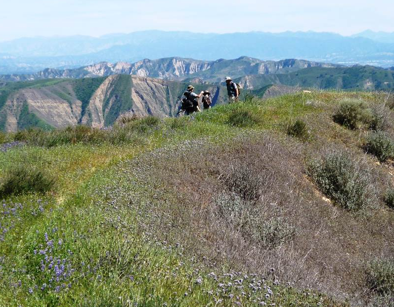
| Images: | View down from atop the initial grassy ridge section. The unseasonably hot January must have triggered this early lupine to bloom. TRICKS ON YOU! In the wilderness, looking down Agua Blanca. Some sort of sling or horse pannier was left over. Trail junction sign, Pothole and Agua Blanca, just downstream of Log Cabin and upstream of the Devils Gateway. One downed tree of significance: 34.5439, -118.8042 |
Pothole Trail Survey - 03-10-2017 - by Mike Maki| Link: | Pothole Trail |
| Date: | 03-10-2017 |
| Surveyor Name: | Mike Maki |
| Trail description: | Uphill section of trail was easy to follow but very overgrown with the recent winter rains. Just need a dozen or so people to hike it and the trail will be in better shape. Once over the top, downhill section was in excellent shape. A couple of minor wash outs from recent storms but nothing major. One tree down after corrugated shed. Hike pics |
| Mode of transport: | Hike |
| Trail condition: | Needs some work |
| Condition details: | Very overgrown on grassy uphill section |
| Images: | Overgrown section Down tree below corrugated shed |
Pothole Trail Survey - 01-28-2017 - by Eric | Link: | Pothole Trail |
| Date: | 01-28-2017 |
| Surveyor Name: | Eric |
| Trail description: | The trail was a bit overgrown due to the recent rains, but well maintained and easy to follow, especially once you make it up to the ridge. |
| Mode of transport: | Hike |
| Trail condition: | Good shape and easy to follow |
| Images: | Beginning of Pothole Trail looking back on Piru Canyon rd On the ridge looking east from Pothole Trail Looking west coming down toward the Pothole Approaching the Pothole |
Pothole Trail Survey - 05-02-2016 - by Los Padres Forest Association| Link: | Pothole Trail |
| Date: | 05-02-2016 |
| Surveyor Name: | Los Padres Forest Association |
| Trail description: | TRAIL UPDATE: The Ojai Ranger District hired The CREW (http://www.thecrew.org/) to work for three weeks from the Sespe Wilderness Boundary down to Log Cabin Camp. Â That section is now 100% stock passable and in the best shape it's been in for years and years, if not decades. |
| Mode of transport: | Array |
| Trail condition: | Good shape and easy to follow |
Pothole Trail Survey - 04-16-2016 - by Daniel Meinzer| Link: | Pothole Trail |
| Date: | 04-16-2016 |
| Surveyor Name: | Daniel Meinzer |
| Trail description: | Maintenance was in progress during our hike. Â Expect it to be in very good shape. Â Water was present at pothole spring. |
| Mode of transport: | Hike |
| Trail condition: | Good shape and easy to follow |
| Images: | |
Pothole Trail Survey - 04-24-2016 - by Gordon A Jenkins| Link: | Pothole Trail |
| Date: | 04-24-2016 |
| Surveyor Name: | Gordon A Jenkins |
| Trail description: | Excellent condition...CREW Ojai just completed a 21-day spike, worked trail from ridge to Log Cabin camp and Devil's Gateway |
| Mode of transport: | Hike |
| Trail condition: | Good shape and easy to follow |
Pothole Trail Survey - 11-15-2015 - by Los Padres Forest Association| Link: | Pothole Trail |
| Date: | 11-15-2015 |
| Surveyor Name: | Los Padres Forest Association |
| Trail description: | Ojai Ranger District patrol of the Pothole Trail. Â There is good water along the bottom of the canyon, including water at the Pothole Cabin. Â There will be a few weeks of trail work by the CREW along this trail later this fall. |
| Mode of transport: | Array |
| Trail condition: | Needs some work |
Pothole Trail Survey - 04-12-2015 - by Los Padres Forest Association| Link: | Pothole Trail |
| Date: | 04-12-2015 |
| Surveyor Name: | Los Padres Forest Association |
| Trail description: | Report from the Ojai Ranger District: The CREW continued work on the Pothole Trail and have now completed 90% of the trail from the wilderness boundary (ridge) down to the Agua Blanca to trail standards. Â If you are going to backpack the Pothole Trail, now is a great time. Â The CREW will be back in the Fall to wrap up that last 10%. More information about the CREW: http://www.thecrew.org/ |
| Mode of transport: | Array |
| Trail condition: | Good shape and easy to follow |
| Images: | Photo Ranger Heidi Photo Ranger Heidi Photo Ranger Heidi |
Pothole Trail Survey - 11-20-2014 - by Los Padres Forest Association| Link: | Pothole Trail |
| Date: | 11-20-2014 |
| Surveyor Name: | Los Padres Forest Association |
| Trail description: | LPFA hosted a Working Vacation along the Pothole Trail. Â Let the pictures tell the story: https://www.facebook.com/media/set/?set=a.375270365931227.1073741836.153337144791218&type=1 |
| Mode of transport: | Array |
| Trail condition: | Needs some work |
| Images: | |
Pothole Trail Survey - 03-15-2015 - by Los Padres Forest Association| Link: | Pothole Trail |
| Date: | 03-15-2015 |
| Surveyor Name: | Los Padres Forest Association |
| Trail description: | The Ojai Ranger District continued work on the Pothole Trail. Â They worked from the Wilderness boundary down towards the Agua Blanca. Â The Pothole Trail is seeing a lot of work this year with multiple projects hosted by the ORD, LPFA and CREW. Photos: Ranger Heidi |
| Mode of transport: | Array |
| Trail condition: | Needs some work |
| Images: | |
Pothole Trail Survey - 09-06-2014 - by Los Padres Forest Association| Link: | Pothole Trail |
| Date: | 09-06-2014 |
| Surveyor Name: | Los Padres Forest Association |
| Trail description: | LPFA scouted from Agua Blanca up to the Potrero for a future trail project. Â Information here: http://bit.ly/1pcaIwk |
| Mode of transport: | Hike |
| Trail condition: | Needs some work |
 Survey / Report Form - Please click this box to open the form.